|
|||||||||||
 | |||||||||||
|
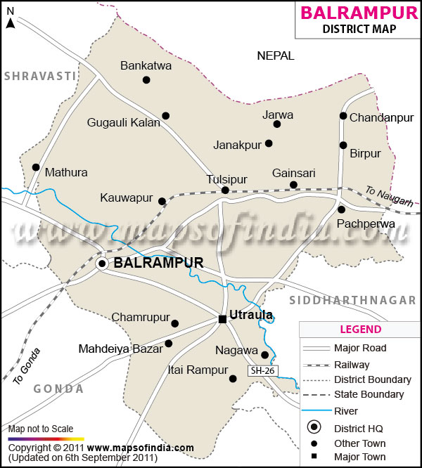
| *The Map showing the National Highway, Major roads, other Roads, District Headquarter, Town, etc in the Balrampur District, Uttar Pradesh | Disclaimer |
| Facts of Balrampur District | |
|---|---|
| State | Uttar Pradesh |
| District | Balrampur |
| District HQ | Balrampur |
| Population (2011) | 2148665 |
| Growth | 27.72% |
| Sex Ratio | 928 |
| Literacy | 49.51 |
| Area (km2) | 3349 |
| Density (/km2) | 642 |
| Tehsils | Balrampur, Tulsipur, Utraula |
| Lok Sabha Constituencies | Shravasti |
| Assembly Constituencies | Balrampur, Gainsari, Tulsipur, Utraula |
| Languages | Hindi, Urdu |
| Rivers | Rapti |
| Lat-Long | 27.425414,82.314262 |
| Travel Destinations | Temple Of Pateshwari Devi, The Sobhnath Temple, Shwetambar Temple etc. |
| Government Colleges/Universities | --- |
Last Updated on : February 19, 2026