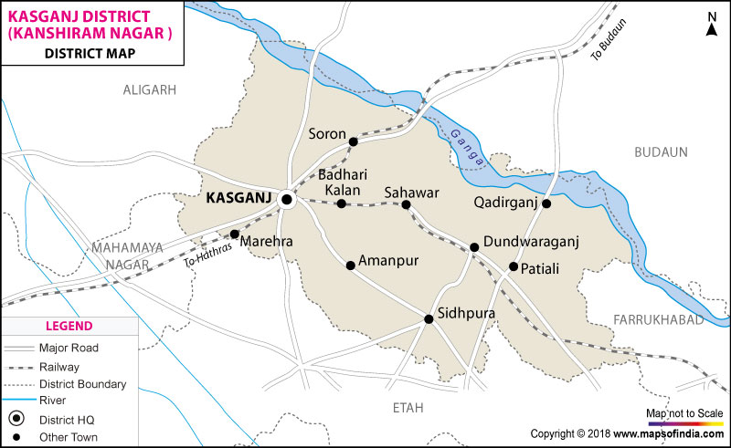
| Facts of Kasganj (Kanshiram Nagar) District | |
|---|---|
| State | Uttar Pradesh |
| District | Kasganj (Kanshiram Nagar) |
| District HQ | Kasganj |
| Population (2011) | 1436719 |
| Growth | 16.93% |
| Sex Ratio | 880 |
| Literacy | 61.02 |
| Area (km2) | 1955 |
| Density (/km2) | 736 |
| Tehsils | Kasganj, Patiyali, Sahawar |
| Lok Sabha Constituencies | Etah |
| Assembly Constituencies | 3-Amanpur, Kasganj, Patiyali |
| Languages | Hindi, Urdu |
| Rivers | --- |
| Lat-Long | 27.804917,78.643717 |
| Travel Destinations | Nadrai Ka Pul, 84 Man Ka Ghanta, Prabhu Park, Chamunda Mandir, Kali Mandir, Bhuteshwar Mandir And Hulka Mandir etc. |
| Government Colleges/Universities | Dr. Islam Majeed Degree College, Ch. Shri Ram Yadav Degree College, Hajjan Sadika Begam Degree College, K.C. Adarsh Degree College, Shri S.S. Degree College, Shri P.L. Degree College, Shri C.R. Singh Degree College, Sir M.U. Degree College, Dr. R. Siddhartha Degree College, Smt. Genda Devi Degree College, Ch. R.P. Yadav Degree College, Govt. Degree College, Dr. R.M. Lohiya Degree College, M.R. Degree College etc. |
Last Updated on : January 14, 2026
|
|
