|
|||||||||||

| |||||||||||
|
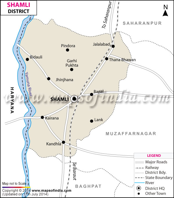
| *The Map showing the National Highway, Major roads, other Roads, District Headquarter, Town, etc in the Shamli District, Uttar Pradesh | Disclaimer |
| Facts of Shamli District | |
|---|---|
| State | Uttar Pradesh |
| District | Shamli |
| District HQ | Shamli |
| Population (2011) | * |
| Growth | * |
| Sex Ratio | * |
| Literacy | * |
| Area (km2) | * |
| Density (/km2) | * |
| Tehsils | Shamli, Kairana |
| Lok Sabha Constituencies | Kairana |
| Assembly Constituencies | Kairana, Shamli, Thana Bhawan |
| Languages | Hindi, Urdu |
| Rivers | --- |
| Lat-Long | 29.447969,77.310591 |
| Travel Destinations | Hanuman Tilla etc. |
| Government Colleges/Universities | Govt. Girls Polytechnic College, R. K. Post Graduate, Hindu Maha Vidhayalya etc. |
Last Updated on : February 19, 2026