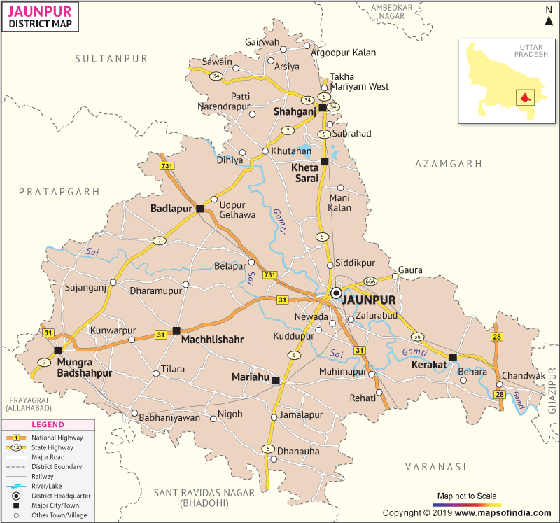
Jaunpur falls under the Varanasi Division of Uttar Pradesh. It covers a total area of 4,038sq.km. The population in the district of Jaunpur is 44,76,072. The headquarters is located in Jaunpur.
| Facts of Jaunpur District | |
|---|---|
| State | Uttar Pradesh |
| District | Jaunpur |
| District HQ | Jaunpur |
| Population (2011) | 4494204 |
| Growth | 14.89% |
| Sex Ratio | 1024 |
| Literacy | 71.55 |
| Area (km2) | 4038 |
| Density (/km2) | 1108 |
| Tehsils | Badlapur, Jaunpur, Kerakat, Machhlishahr, Mariahu, Shahganj |
| Lok Sabha Constituencies | Jaunpur, Machhlishahr |
| Assembly Constituencies | Badalpur, Jaunpur, Kerakat, Machhlishahr, Malhani, Mariyahu, Mungra Badshahpur, Shahganj, Zafrabad |
| Languages | Hindi, Urdu |
| Rivers | Gomti, Sai |
| Lat-Long | 25.725684,82.687797 |
| Travel Destinations | Shahi Qila, Main Gate, Atala Mosque, Jhanjhari Mosque, Lal Darwaza Mosque, Jama Mosque, Shahi Pul, Kali Temple, Gasuri Shankar Temple, Hanuman Temple, Kabir Math, Gomteshwar Mahadev etc. |
| Government Colleges/Universities | Veer Bahadur Singh Purvanchal University, T D College etc. |
Last Updated on : January 14, 2026
