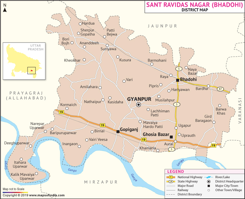
Population of Sant Ravidas Nagar District in 2011 is 1554203.
Most of the people of the district are engaged in the 'Carpet' industry which earns revenues for the district. The district is famous for hand woven carpets.
The tourist attraction of Sant Ravidas Nagar is a historical place called 'Sitamadhi'.
| Facts of Sant Ravidas Nagar District | |
|---|---|
| State | Uttar Pradesh |
| District | Sant Ravidas Nagar |
| District HQ | Gyanpur |
| Population (2011) | 1578213 |
| Growth | 16.58% |
| Sex Ratio | 955 |
| Literacy | 68.97 |
| Area (km2) | 960 |
| Density (/km2) | 1531 |
| Tehsils | Aurai, Bhadohi, Gyanpur |
| Lok Sabha Constituencies | Bhadohi |
| Assembly Constituencies | Aurai, Bhadohi, Gyanpur |
| Languages | Hindi, Urdu |
| Rivers | Ganga |
| Lat-Long | 25.319201,82.435513 |
| Travel Destinations | Baba Harihar Nath Temple, Sai Dhaam, Chakwa Mahavir Mandir, Ghopaila Devi Mandir, Gyan Sarovar, Raja Park, Mukherjee Park etc. |
| Government Colleges/Universities | Kashi Naresh Post Graduate Collage (K.N.P.G), Ram Dev P. G. College, Buddhiram Dubey Mahila Mahavidyalaya, Vimal Singh Mahavidyalaya etc. |
Last Updated on : January 14, 2026
